歡迎加入我們的直播。BricsCAD V27 即將於 00:00:00

立即註冊

搜尋

土地測量工具

使用專為測量師工作方式而設計的工具來發揮效能。
免費試用 BricsCAD
可用於 BricsCAD

BIM

終極版

Lite

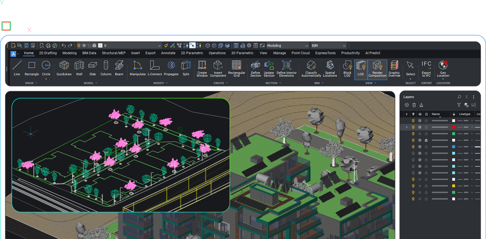
BricsCAD BIM interface showing a 3D urban site model with buildings and trees, alongside a 2D landscape layout view.

LEICA 到 BRICSCAD

從 Leica 儀器快速輕鬆存取測量資料

一鍵匯入可讓測量資料從現場流動到 CAD,並保持一致性、完整性和準確性。
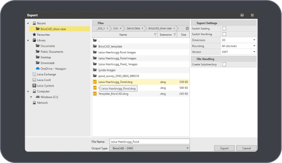
BricsCAD Export dialog showing file browser with DWG files selected, export settings panel with dimension and version options.

從 Leica Infinity 匯出

單鍵匯出可產生增強的 DWG 檔案,包含所有必要的欄位資料,無需重新樣式或重新格式化圖層。
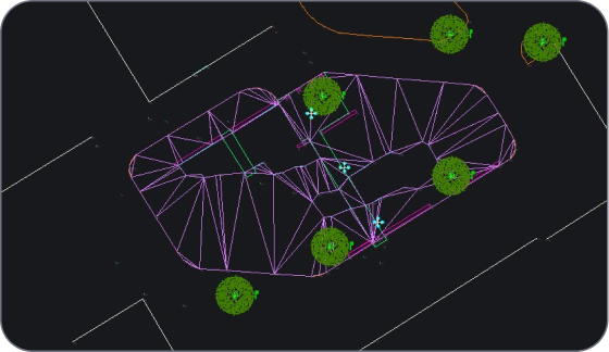
BricsCAD interface showing a 3D wireframe model of a car surrounded by tree symbols in a top-down CAD drawing.

匯入至 BricsCAD® Pro

一鍵匯入可建立包含曲面、點、定線和串的 DWG,以及來自 Leica Infinity 的補充資料。
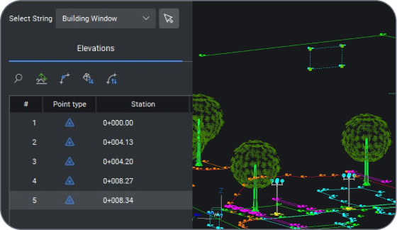
BricsCAD Civil interface showing an Elevations panel with station points and a 3D road design model featuring trees and infrastructure.

提升設計生產力

使用 BricsCAD 功能強大的曲面建模、點群組和串編輯工具來精細設計,並快速有效地建立 CAD 交忖。

測量到 CAD

利用調查資料建立精確的 CAD 交付

從全站儀或 GPS 匯入和管理測量資料,以產生註釋圖、分析契約資訊,以及建立三角網曲面以顯示等高線。

匯入與管理調查資料

在 DWG 中利用 ASCII 點檔案、測量資料和 GIS 資料繼續進行專案。

產生註解的圖面

建立 Civil 斷面和斷面視圖

建立三角網曲面並顯示等高線

跨圖面共用三角網曲面
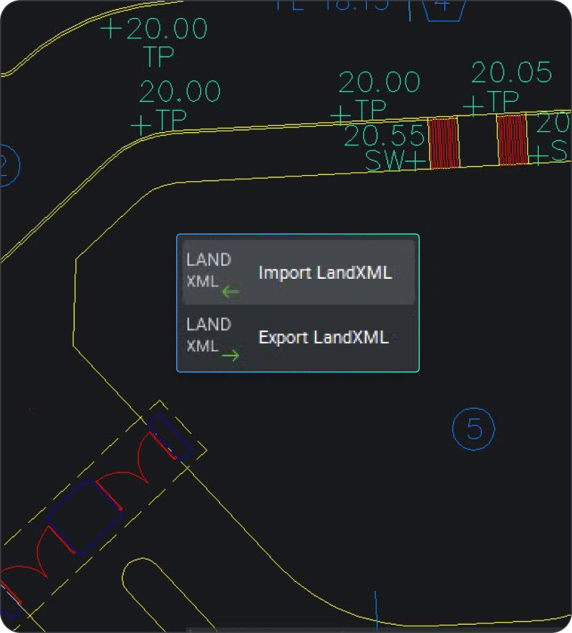
BricsCAD civil drawing showing a road layout with a popup menu displaying Import LandXML and Export LandXML options.

施工定點

實用且精確的施工定點工具

匯入、準備和匯出資料,以便在現場準確定位。
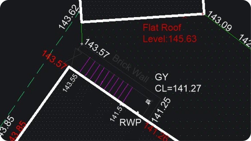
BricsCAD CAD drawing showing a building survey with elevation levels, flat roof at 145.63, brick wall, and RWP annotations.

匯入及管理設計資料

從現場儀器匯入測量點、透過增強的點群 UI 功能進行篩選,以及匯入 LandXML 或 Civil 3D 物件。
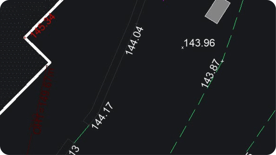
BricsCAD interface showing a civil or survey drawing with elevation contour lines and numerical labels such as 144.04 and 143.87.

為現場定位準備資料

產生土木資料,並準備匯出至測量設備或增強的 LandXML。
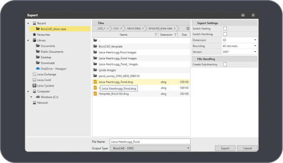
BricsCAD Export dialog showing file browser with DWG files selected, export settings panel with dimension and version options.

匯出資料至測量儀器

匯出至 LandXML 或將現場儀器連接到 Bricsys® 24/7 並匯入資料。
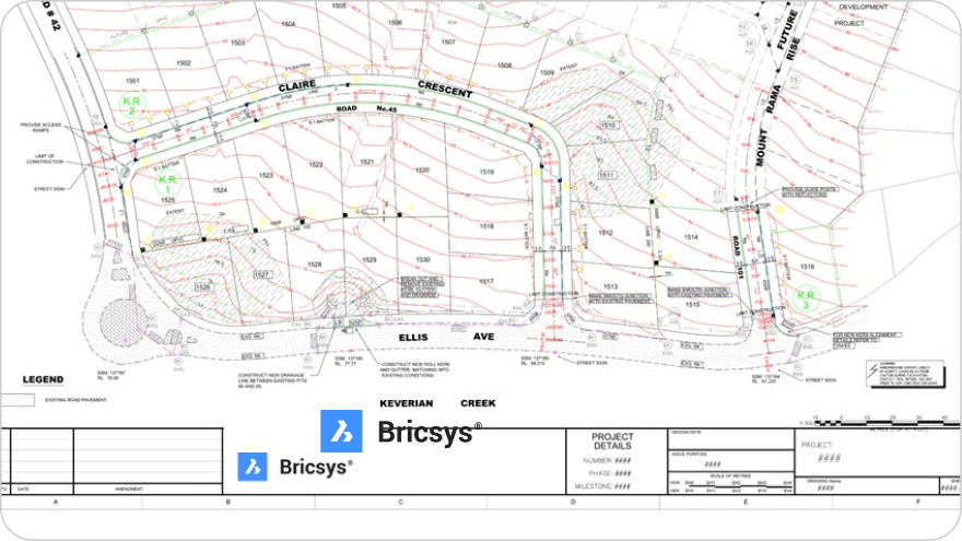
BricsCAD civil engineering drawing showing a road layout plan for Keverian Creek, with contour lines and street details.

建立施工圖和 CAD 交付成果

建立一套施工圖,作為 CAD 交付套件的一部分。

資料互通性

開啟.最佳化.輸出.

在單一 CAD 環境中使用多種資料類型,快速進行設計。您可以匯入、編輯和匯出 GIS 資料、Civil 3D 資料和 LandXML。
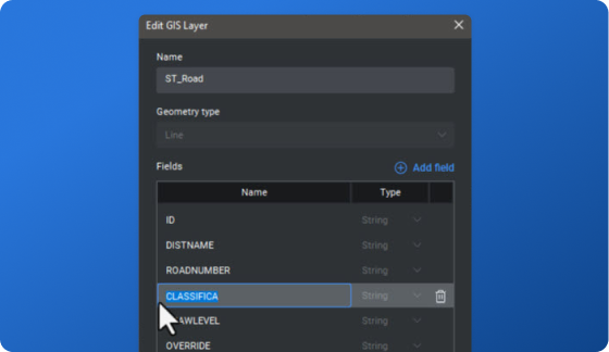
BricsCAD Edit GIS Layer dialog showing ST_Road layer with Line geometry and fields like ID, DISTNAME, ROADNUMBER, and CLASSIFICA.

在一個 CAD 環境中使用 GIS 資料

迴圈 GIS 資料,並從頭建立 GIS 圖層,或在 GIS 工作流程中使用熟悉的 CAD 工具編輯現有檔案。匯入、篩選與搜尋、編輯與建立,以及匯出至 SHP。
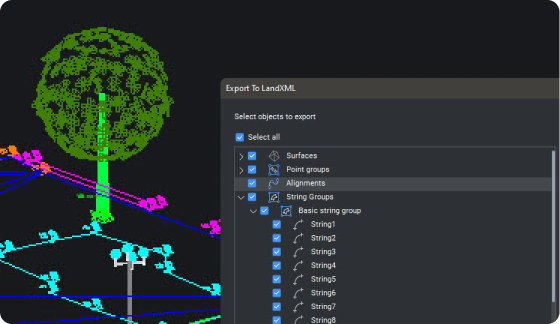
BricsCAD interface showing an Export To LandXML dialog with object selection options alongside a 3D civil site model with a tree.

使用 LandXML 交換資料

使用業界標準的 LandXML 格式匯入、編輯及匯出資料,包括點群、定線、曲面及 3D 串。
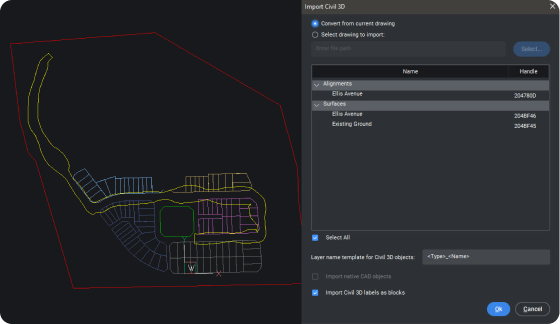
BricsCAD screenshot showing the Import Civil 3D dialog with alignments and surfaces listed alongside a civil site plan drawing.

使用 Autodesk® Civil 3D 資料

使用顯示的代理 Civil 3D 物件作為參考,或匯入 Civil 3D 物件至 BricsCAD 土木物件,以方便存取物件資訊並用於進一步設計。

掃描到三角網曲面

從掃描的資料中得到精確的三角網曲面

利用來自航空、陸地或測深 LiDAR 擷取的掃描資料,建立、編輯及管理高精確度且輕量的三角網曲面。

Pc attach  - Icon

匯入與管理點雲

從多種格式匯入點雲資料,並進行分類以濾除不必要的資料。

Copy string to group - Icon

###從點雲建立測量特徵

對點雲進行分類以排除非地面特徵,並使用 3D 串連和套接來精確地建立測量特徵。

Aimleaderedit add - Icon

###產生註解的圖面

使用以測量師為重點的繪圖工具,例如穿透指令、線與曲線標籤,以及幾何圖形建立器,來產生 CAD 交付。

Tincreate - Icon

精細和管理三角網曲面和等高線

濾除不必要的點、新增或移除分隔線,以及移除外緣。顯示和標示輪廓,並使用曲面平滑來微調三角網曲面。

Tinsurface shared  - Icon

在合作圖面中共用三角網曲面

智慧型參考可輕量平行處理同一三角網曲面。原始圖面的任何設計變更都會提示其他使用者更新至最新的迭代。

BricsCAD 的所有功能

探索所有 BricsCAD 工具集
30 天試用

今天就開始使用 BricsCAD 進行設計吧!

可用於 Microsoft, Mac 和 Linux 圖示
免費試用 BricsCAD
Six BricsCAD views showing scaffolding structures, a 2D elevation drawing, pipe joints, and a 3D building model.